Holiday Packages
All our itineraries include:
- Hand-picked accommodation in B&Bs / guest houses / inns / small hotels
- Accommodation before and after your walk
- Breakfast
- Daily baggage transfers from our own team of local drivers
We will also endeavour to include all these in any custom itinerary you wish to build for this walk.
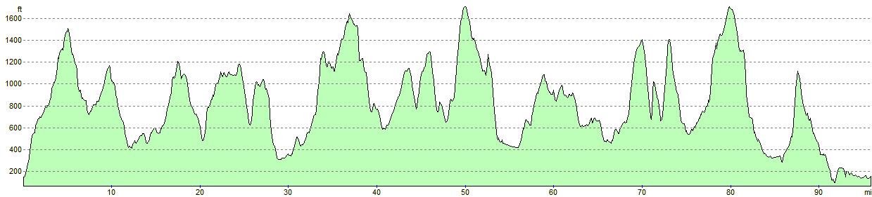
Day 1: Billington to Gisburn (14m)
Day 2: Gisburn to Skipton (16.2m)
Day 3: Skipton to Malham (17.6m)
Day 4: Malham to Slaidburn – taxi to Settle (18.8m)
Day 5: Taxi to Slaidburn, walk to Gibbon Bridge, near Chipping (18.2m)
Day 6: Gibbon Bridge to Billington (11.6m)
£880 per person (based on two sharing – taxis included)
Day 1: Billington to Gisburn (16.5m)
Day 2: Gisburn to Skipton (17.9m)
Day 3: Skipton to Linton (10.6m)
Day 4: Linton to Settle (12.8m)
Day 5: Settle to Slaidburn – taxi to Settle (13m)
Day 6: Taxi to Slaidburn, walk to Gibbon Bridge, near Chipping (18.2m)
Day 7: Gibbon Bridge to Billington (10.6m)
£1,090 per person (based on two sharing – taxis included)
* All headline holiday prices are shown per person, based on two people sharing.
** Prices may vary depending on availability, time of year, number of travellers and room type. Please enquire for a personalised quote.
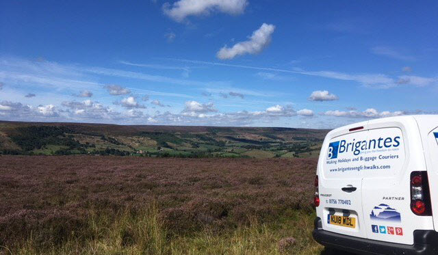
Baggage Transfer
Baggage Transfer is automatically included in the price of all our Walking Holiday packages.
These prices are for anyone planning their own holiday and just need bags moving from one stop to the next.
Please enquire for prices
Note: If you are booking accommodation in an Airbnb, you must ensure that there will either be someone available to take collection/delivery of your bags or that they have appropriate, secure storage in the event that the proprietor is absent.
2 Replies to “Two Roses Way”
We have just completed the Two Roses Walk. We would like to thank Brigantes for the excellent bag transfer service. We have used this service several times now and it has always been a very reliable and efficient service. Great organisation and always helpful. Thank you.
The walk itself was beautiful. We had been to the Yorkshire Dales many times but hadn’t ventured into the Ribble Valley, which was lovely. Parts of the walk were more challenging from a navigation point of view than some we have undertaken. It is not sign posted like the Wolds Way or the Dales Way. Some of the paths were across open access land which proved more difficult, especialy as it was quite boggy. We had a problem finding the path through the forest, near the stream, on the stretch from Settle to Slaidburn.
Hi Lynn, so sorry to hear you had navigation problems on the Two Roses Way. I devised the route and drew the sketch maps for the Sigma Press book. The route is now 40 year’s old and the guide book needs updating to take account of changes. Please accept my apologies for the difficulties you had. Peter Billington