St. Hilda's Way
40 mile walk dedicated to Anglo-Saxon princess, St. Hild

St Hilda’s Way is a 40 miles long-distance trail in North Yorkshire, starting from Hinderwell and finishing at Whitby Abbey. The walk is designed as a pilgrimage and visits eight Churches and Chapels all dedicated to St Hilda, as well as two other churches named after St Hedda and St Mary.

The Way was the idea of the Whitby Anglican churches and its format was inspired by the icon of St Hilda written by Edith Reyntiens, who has given her permission for it to be used in the book. Veteran long-distance walkers, Nancy and John Eckersley, have lent their assistance in devising the route and writing the guidebook and there was a launch pilgrimage in 2015.

Download file for GPS

Holiday Packages

All our Standard Itineraries include:

  • Hand-picked accommodation in B&Bs / guest houses / inns / small hotels
  • En-suite facilities where available
  • Breakfast
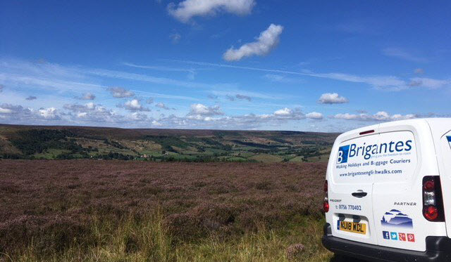
  • Daily baggage transfers from our own team of local drivers
  • All booking fees

We will also endeavour to include all these in any custom itinerary you wish to build for this walk.

Itin A:   3D / 4N       £430 pp *

Day 1: Hinderwell to Ainthorpe (after Church Houses loop) (13.6m)
Day 2: Ainthorpe to Egton Bridge (after Egton loop) (12.8m)
Day 3: Egton Bridge to Whitby (14.1m)

£485 solo walkers (plus single supplements)
£430 per person (based on two sharing)
£410 per person (based on group of 3)
£400 per person (based on group of 4 or more)

Get a Personal Quote

Itin B:   2D / 3N       £315 pp *

Day 1: Hinderwell to Glaisdale (21.2m)
Day 2: Glaisdale to Whitby (18.7m)

£350 solo walkers (plus single supplements)
£315 per person (based on two sharing)
£305 per person (based on group of 3)
£300 per person (based on group of 4 or more)

Get a Personal Quote

Itin C:   4D / 5N       £520 pp *

Day 1: Hinderwell to Danby (10m)
Day 2: Danby to Glaisdale (11.2m)
Day 3: Glaisdale to Sleights (9.7m)
Day 4: Sleights to Whitby (9m)

£575 solo walkers (plus single supplements)
£520 per person (based on two sharing)
£505 per person (based on group of 3 or more)

Get a Personal Quote

Itin D:   5D / 6N       £615 pp *

Day 1: Hinderwell to Danby (10m)
Day 2: Danby to Lealholm (8.8m)
Day 3: Lealholm to Egton Bridge (after Egton loop) (7m)
Day 4: Egton Bridge to Sneaton (7.6m)
Day 5: Sneaton to Whitby (6.5m)

£680 solo walkers (plus single supplements)
£615 per person (based on two sharing)
£600 per person (based on group of 3 or more)

Get a Personal Quote

* All headline holiday prices are shown per person, based on two people sharing.

Baggage Transfer

Baggage Transfer is automatically included in the price of all our Walking Holiday packages.

These prices are for anyone planning their own holiday and just need bags moving from one stop to the next.

Itin A

£115 per person (single)
£60 per person (based on two people)
£40 per person (based on group of 3)
£10 per person per day (based on group of 4 or more)

Max 17kg per bag

Itin B

£70 per person (single)
£35 per person (based on two people)
£25 per person (based on group of 3)
£10 per person per day (based on group of 4 or more)

Max 17kg per bag

Itin C

£110 per person (single)
£55 per person (based on two people)
£10 per person per day (based on group of 3 or more)

Max 17kg per bag

Itin D

£130 per person (single)
£65 per person (based on two people)
£10 per person per day (based on group of 3 or more)

Max 17kg per bag

Note: If you are booking accommodation in an Airbnb, you must ensure that there will either be someone available to take collection/delivery of your bags or that they have appropriate, secure storage in the event that the proprietor is absent.

Walk Information

Rest Days
Rest days can be incorporated into any walking holiday package at an additional £65.00 per person per night

Solo Travellers
Solo travellers please contact us or use the booking form to send your proposed itinerary including dates, and we will price accordingly. Where possible, we take advantage of existing bookings from other clients to ensure you receive a cost effective service.

Alternative Itineraries
For alternative itineraries to those provided for this route, please contact us, or use the Booking Form to submit your proposed itinerary and number of participants and we will quote accordingly.

Walking Season Dates
Prices are based on the walk starting after 1st April and ending before 30th September.

Walk Information
St Hilda’s Way is a 40 miles long-distance trail in North Yorkshire, starting from Hinderwell and finishing at Whitby Abbey. The walk is designed as a pilgrimage and visits eight Churches and Chapels all dedicated to St Hilda, as well as two other churches named after St Hedda and St Mary. At each location there is a special focus on a different aspect of the saint’s life, something to find in the church and the opportunity for reflection and meditation.

The Way was the idea of the Whitby Anglican churches and its format was inspired by the icon of St Hilda written by Edith Reyntiens, who has given her permission for it to be used in the book. Veteran long-distance walkers, Nancy and John Eckersley, have lent their assistance in devising the route and writing the guidebook and there was a launch pilgrimage in 2015.

St Hilda’s Way celebrates the life of St Hild, Anglo-Saxon princess, spiritual leader, arts enthusiast and peacemaker, by visiting places dedicated to her (including eight churches) in the beautiful North Yorkshire countryside. In 664 she hosted the famous Synod of Whitby as the first abbess of the double monastery of Streonshalh, now known as Whitby Abbey. It is said that seabirds in Whitby still dip their wings in honour of her.

OS Explorer Maps
OL27 – North York Moors – Eastern area

Other Maps
Cleveland Way A-Z Adventure Atlas” – Published by Geographers’ A-Z Maps – ISBN: 978-1-78257-196-4

Guide Books
Walking St Hilda’s Way” by Nancy & John Eckersley – Published by Dales Court Press – ISBN: 978-0956789020

Mobile Digital Mapping
Digital maps can be viewed on most modern smartphones using an appropriate app, downloaded from the app store associated with your device. Brigantes recommend that whichever app you use, it should support Ordnance Survey 1:25k or 1:50k scale maps. There are many apps to choose from, but the two main providers are Ordnance Survey and Memory Map.

Each provider’s app has its own benefits, but both provide all-important offline navigation, meaning your device does not need a mobile signal to work effectively on the trail.

Walks you may also like...

Inn Way to the North York Moors

Inn Way to the North York Moors

The North Yorks Moors Inn Way is a 92 mile circular walk, visiting 31 traditional inns and some splendid moorland scenery
Click Here

St. Bega's Way

St. Bega's Way

The 36 mile St. Bega's Way links St Bega's church in St Bees, to the church of the same name by the shores of Bassenthwaite Lake
Click Here

Whitby Way

Whitby Way

The Whitby Way is a 71 mile walk through the Vale of York and over the North York Moors visiting many of its pilgrimage places
Click Here
Search

Walkers' Testimonials

Have you walked this route? Please leave a review and let others know what you think.

Use the comments form below to submit your testimonial for this walk. Rest assured, we won’t display or disclose your email address! It is only required to prevent spam – and to enable you to receive notifications of any responses to your review should you select the option to do so.

Leave a Reply

Your email address will not be published. Required fields are marked *

This site uses Akismet to reduce spam. Learn how your comment data is processed.