Swale Way
77 mile walk following the River Swale and Swaledale

The 77 mile Swale Way follows the length of the River Swale in North Yorkshire from its confluence with the River Ure near Boroughbridge to its source at the head of Swaledale in the Yorkshire Dales National Park

Download file for GPS

Holiday Packages

All our itineraries include:

  • Hand-picked accommodation in B&Bs / guest houses / inns / small hotels
  • Accommodation before and after your walk
  • Breakfast
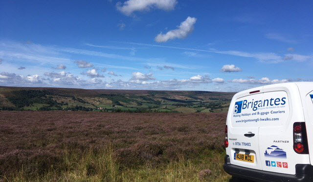
  • Daily baggage transfers from our own team of local drivers

We will also endeavour to include all these in any custom itinerary you wish to build for this walk.

Itin A:   6D / 7N       £870 pp *

Day 1: Boroughbridge to Thirsk (16.3m)
Day 2: Thirsk to Morton on Swale (12.4m)
Day 3: Morton on Swale to Richmond (14.8m)
Day 4: Richmond to Reeth (12.3m)
Day 5: Reeth to Keld (11.7m)
Day 6: Keld to Kirkby Stephen (12.1m)

£870 per person (based on 2 sharing)

Get a Personal Quote

Itin B:   4D / 5N       £630 pp *

Day 1: Boroughbridge to Kirby Wiske (21.6m)
Day 2: Kirby Wiske to Richmond (21.1m)
Day 3: Richmond to Low Row (17.2m)
Day 4: Low Row to Kirkby Stephen (19.2m)

£630 per person (based on 2 sharing)

Get a Personal Quote

Itin C:   5D / 6N       £750 pp *

Day 1: Boroughbridge to Thirsk (16.3m)
Day 2: Thirsk to Morton on Swale (12.4m)
Day 3: Morton on Swale to Richmond (14.8m)
Day 4: Richmond to Low Row (17.2m)
Day 5: Low Row to Kirkby Stephen (19.2m)

£750 per person (based on 2 sharing)

Get a Personal Quote

Itin D:   7D / 8N       £980 pp *

Day 1: Boroughbridge to Brafferton (6.7m)
Day 2: Brafferton to South Kilvington (10.9m)
Day 3: South Kilvington to Morton on Swale (11.1m)
Day 4: Morton on Swale to Catterick Bridge (12.9m)
Day 5: Catterick Bridge to Grinton (14.5m)
Day 6: Grinton to Keld (12.6m)
Day 7: Keld to Kirkby Stephen (12.1m)

£980 per person (based on 2 sharing)

Get a Personal Quote

Itin E:   8D / 9N       £1090 pp *

Day 1: Boroughbridge to Brafferton (6.7m)
Day 2: Brafferton to South Kilvington (10.9m)
Day 3: South Kilvington to Morton on Swale (11.1m)
Day 4: Morton on Swale to Catterick Bridge (12.9m)
Day 5: Catterick Bridge to Grinton (14.5m)
Day 6: Grinton to Low Row (5.8m)
Day 7: Low Row to Keld (7.8m)
Day 8: Keld to Kirkby Stephen (12.1m)

£1,090 per person (based on 2 sharing)

Get a Personal Quote

* All headline holiday prices are shown per person, based on two people sharing.

** Prices may vary depending on availability, time of year, number of travellers and room type. Please enquire for a personalised quote. 

Walk Information

Rest Days
Rest days can be incorporated into any walking holiday package.

Solo Travellers
Solo travellers please contact us or use the booking form to send your proposed itinerary including dates, and we will price accordingly. Where possible, we take advantage of existing bookings from other clients to ensure you receive a cost effective service.

Alternative Itineraries
For alternative itineraries to those provided for this route, please contact us, or use the Booking Form to submit your proposed itinerary and number of participants and we will quote accordingly.

Walking Season Dates
Prices are based on the walk starting after 1st April and ending before 30th September.

Walk Information
The Swale Way was originally conceived by John Brock of the Ramblers Association in 1995 and the pen and ink drawings reproduced in the route descriptions are from original artwork by Richard Collier.

The 77 mile walk follows the length of the River Swale in North Yorkshire from its joining with the River Ure near Boroughbridge to its source at the head of Swaledale in the Yorkshire Dales National Park. Along the way it passes through the historic market towns of Boroughbridge, Thirsk and Richmond, past famous battle sites and historic parkland, and travels the length of Swaledale, one of the most beautiful of all the Yorkshire Dales.

Guide Books
The Swale Way” by Stuart W. Greig – Published by Pocket Routes

Mobile Digital Mapping
Digital maps can be viewed on most modern smartphones using an appropriate app, downloaded from the app store associated with your device. Brigantes recommend that whichever app you use, it should support Ordnance Survey 1:25k or 1:50k scale maps. There are many apps to choose from, but the two main providers are Ordnance Survey and Memory Map.

Each provider’s app has its own benefits, but both provide all-important offline navigation, meaning your device does not need a mobile signal to work effectively on the trail.

Walks you may also like...

Yoredale Way

Yoredale Way

The Yoredale Way is a 73 mile walk from the source of the river Ure, across the Dales, almost to its end at Boroughbridge
Click Here

Tributaries Walk

Tributaries Walk

The Tributaries Walk is a 95 mile circular walk exploring the water courses of the Dales and the hills and moorland between them
Click Here

Yorkshire Wolds Way

Yorkshire Wolds Way

The Yorkshire Wold Way is a gentle 78 mile walk through the chalk hills, from the Humber estuary to the dramatic Cleveland coast
Click Here
Search

Walkers' Testimonials

Have you walked this route? Please leave a review and let others know what you think.

Use the comments form below to submit your testimonial for this walk. Rest assured, we won’t display or disclose your email address! It is only required to prevent spam – and to enable you to receive notifications of any responses to your review should you select the option to do so.

Leave a Reply

Your email address will not be published. Required fields are marked *

This site uses Akismet to reduce spam. Learn how your comment data is processed.